Mile 3.3 Dinely Bridge Put-in
Gauge located on old bridge footing left.Mile 3.4 Dinely (Class 3)
Rapid below Dinely Bridge. Avoid the rebar remaining from the flood of 1955.Flood of Jan 97 Update: The rapid is sraightened out and the concrete block loaded with rebar has moved downstream 150 feet and over to the left channel and out of play. The block is out of the water below .9ft and most of the rebar is pointing downstream. A good low water project would be to cut off all the protruding steel. Volunteers?
Mile 3.5 ENDER HOLE (Class 2 and above depending on your state of mind)
Ender Spot above 1.4 feet becoming killer hole at high water.Flood of Jan 97 Update: The hole has changed. It is now better than ever at .5ft to .6ft on the gauge. Can you say AUTO ENDER? The owner of the property adjacent the hole has just taken up kayaking. Guess he got tired of watching everybody eddy out in his hole for a little fun.
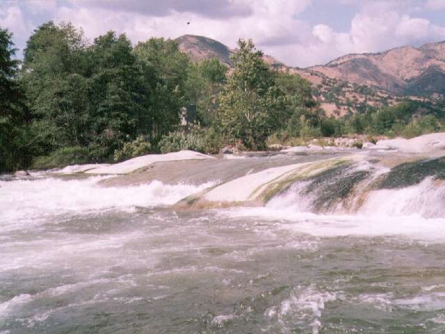
Mile 3.7 STONY BROKE (CAT EYE) (Class 4-)
Big rapid below power plant on right, difficult scout. Run center channel and move right to avoid huge holes left and center at bottom. Rafts like the right channel. 130 cfs is added to the river from the SCE Powerplant No.2Flood of Jan 97 Update: Major change has occorred. 150 feet of lower end of the island that formed the left bank is gone. The center and right channels are gone. The route is far left at the top and a hard move right half way down to avoid the large hole on the left side. The alternate route through the jacuzzi pool on the far far right is widened, less technical, and accessable at a wider range of flows.
Mile 4.1 Dislocation (Class 3+)
Right/Left twisting drop at 20 foot monolith rock on left. The lower the flow the more the twist. The source of it’s name is obvious.Flood of Jan 97 Update: The twist has been taken out of the rapid. Easy to stay right. In fact, there's a new channel on the right side but it's still more fun to eddy out behind the big rock on the left.
Mile 4.4 Toilet Bowl (Class 3)
River bends left and swirling water on the right side makes for some play spots.Flood of Jan 97 Update: The right channel through the toilet bowl is the same. A high water rapid in a left channel is now available. A strainer tree has been in the river above Toilet Bowl on the right side of the channel the entire '97 season. I hope someone cuts it out before next year.
Mile 4.7 Ditch Now (Class 3+)
A steep rock garden at 140 ft/mile that is usually run on the right.Flood of Jan 97 Update: Same route, better rapid. Try the far left side for a pleasant alternative.
Mile 5.2 SUICIDE FALLS (Class 4)
Sneak left recommended at medium/high flows! Scout right. Complex water right above the drop makes a perfect run off the nose of the falls harder than it looks. Some guide books overrate this rapid. It’s mainly just a cheap thrill at any normal flow.Flood of Jan 97 Update: No longer a cheap thrill. The stopper hole on the top makes a run off the nose even harder. The hole below the main drop is bigger and stickier than ever. Hug the left side of the main drop to avoid the hole. The high flow far left cheat route is still there above 1800 cfs.
Mile 5.3 The Chair (Class 3+)
Big, big hole center, very sticky below 2.1 feet. The first major pool on the river follows.Flood of Jan 97 Update: The chair was starting to form as the river dropped to 1600 cfs. The hole looked pretty sticky at 900 cfs but I haven't heard and first hand reports as to it's thrashing potential.
Mile 5.7
North Fork Kaweah enters on right.Flood of Jan 97 Update: The flood did some major rearranging of the river just above the confluence. Water now flows down the left bank right behind the Naturedome. Take either the first or second channel down to the confluence. Watch the piton rock in the center of the second channel.
 Upper Slicky at 1400 cfs
Mile 5.9 UPPER SLICKY aka. Grady's Ledges (Class 4)
Bus sized boulders, holes. Scout left. Please avoid the undercut rock in the right channel.Flood of Jan 97 Update: A large 10 foot boulder is lodged up against the undercut rock on the right. The route remains the same. The right channel up against the undercut rock was loaded with strainers during the '97 season.
 Lower Slicky at 1400 cfs
Mile 6.0 LOWER SLICKY (Class 5)
Mandatory scout at sloping 8 foot ledge, KEEPER at bottom! Very Dangerous drop at high flows, but if you insist on running it, enter 8 feet right of the boulder at the top, paddle like hell and cross your fingers. At high water it's best to take the chicken route off the slab 30 feet left of the main drop. One local boater can attest to the risks associated with trying to run this rapid at high water. The class 5 rating applies only at the higher levels. It's a cheap thrill class 3 at lower levels.Flood of Jan 97 Update: The main drop is unchanged. Brush has been swept away on the right opening another cheat route. The left bank has been severely eroded. The abovementioned local paddler again tested the meat of the main drop at 2400 cfs and again had to swim out. The boat without airbags stayed in another 3 mimutes. The small play ledge 200 feet below Slicky is now a major river wide hole.
Mile 6.1 Take out
Take out on the left bank behind the Cort Gallery
Look upstream at Gateway Section (Class 4)
Continue downsream Town of Three Rivers to the Lake (Class 2+)

Copyright © 1996, 1997 by Bill Pooley. All rights reserved.
This page is http://www.c2.com/kaweah/log_dinely23rivers.html
Last modified: 07.17.97